As Edmonton continues to advance its Active Transportation Network Expansion, progress has been...
City admin wants a new road bridge — where’s the evidence?
You may have heard:The City plans to replace the existing 76 Ave road bridge as part of a package that also renews the Mill Creek trestle bridge, upgrades the culvert, and stabilizes the ravine banks. We support the trestle bridge renewal, culvert work, and bank stabilization. Our concern is the road-bridge replacement: Administration has referenced “5,000–6,000 vehicles/day,” but has not released the traffic counts, diversion modelling, or transit/BRT plans they say support rebuilding a general-traffic bridge here. If the case rests on those numbers, they should be public before Council locks in a 75–100-year decision and the associated costs of a project like this.
When making a decision to spend $22.8 million dollars, council should be asking more questions, and we should all expect more transparency from city administration.
What this post covers
-
The evidence gap: what data is missing and why it matters.
-
The cost picture for the road bridge only: ongoing operating and maintenance in a winter city, and why a debt-financed project means annual property-tax impacts from amortization and interest—even before Operations & Maintenance.
-
How this choice fits (or doesn’t) with City Plan mode-share and climate goals.
-
A business lens: access for customers and staff, and whether a like-for-like road bridge is good value.
-
Our asks to Council: publish the evidence, compare options in public on full life-cycle costs and outcomes, and pilot low-cost fixes before committing.
Why you should care
-
You pay for it: if the bridge’s capital share is financed, taxpayers carry annual debt service plus rising O&M for decades.
-
It sets the pattern: rebuilding general-traffic capacity in a ravine locks in car dependency when we’ve committed to shift trips to transit and active modes.
-
It affects local businesses: access can be maintained with or without a car bridge at this point; if we’re spending millions, we should be sure it buys real value.
-
It’s about trust: big infrastructure should be justified with public data, not unpublished claims.
TL;DR
-
Design is underway to replace the bridge along 76 Avenue and the nearby trestle bridge; construction is expected to start late 2025. Project budget (both bridges + associated works): $22.8 M. Source: City of Edmonton
-
What’s missing:
-
There are no published traffic counts, diversion modelling (where traffic would go under different options), or ETS plans to justify a car bridge here. Source: City of Edmonton
-
Annual operating expenses aren't available. Our estimate of ongoing cost (typical year): ~$1.3–$1.5 M/yr (debt + operations/maintenance).
If we're investing this kind of money, the public deserves to know why other options were not considered, how much could be saved by exploring those other options, and what the long-term implications of each option would be, especially in light of the City's climage change and modal share goals.
-
-
Big-picture policy:
City Plan targets ~50% of trips by transit + active modes at ~2 million population. New car capacity should clear a high, evidence-based bar—especially in our ravines. Background data: Edmonton Public Meetings -
Our stance:
Yes to the trestle + creek/bank rehab + the necessary culvert fix; no to yet another car bridge until the analysis is public and shows that this is indeed the best value for our tax dollars and aligns with the City's own goals.
How you can help
If you think that building a bridge based on what appears to be no data whatsoever, while also taking the city further from their stated goals, please write your councillor to let them know that you want the road bridge to be removed from this project, or at the very least, data to be released justifying this expense.
If you aren't sure how to do that, you can find your councillor here, and the email will be listed once you select them:
https://www.edmonton.ca/city_government/mayor-city-councillors
Where we are at in the process
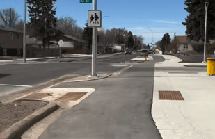
The City’s project page confirms detailed design is underway to renew the Mill Creek trestle bridge, replace the existing 76 Ave road bridge, replace/upgrade the culvert and hydraulics, and stabilize ravine banks. Construction is expected to start in late 2025.
The City’s FAQ (May 2025) says four options were reviewed and that Option 3—a roadway bridge with creek realignment—was selected. It lists a combined budget of $22.8 million for the package and notes resident-level engagement is limited due to the project’s “technical nature”. Costs were not estimated for the other options and they were not considered (based on what's publicly available) seriously.
Urban Planning Committee considered the Environmental Impact Assessment and Site Location Study on August 11, 2025 (item IIS02807) and the minutes are here. Minutes are not yet available, but the motion passed. This will come to council soon though the date does not appear to have been confirmed yet.
The missing evidence
Administration has referenced 5,000–6,000 Average Daily Trips (ADT) for 76 Ave, but no public ADT counts or diversion modelling appear in the posted materials. If claims about impacts to Argyll, Whyte (82 Ave), or emergency response are central to the case, the counts and the model should be published so Council and the public can evaluate them. The FAQ sets a recommendation, but it does not include ADT tables, diversion scenarios (data modelling about where traffic would go if 76 Ave is closed which it will at least be during the contstruction process), or any ETS/BRT plan for this corridor. That is a transparency gap.
Even if the 5000-6000 ADT is correct, it's worth noting that there are two major arterials nearby (82 Ave and Argyll Road), while 76 Ave itself is only a collector road. 82 Ave alone could handle that capacity across the ravine:
- There are ~25,000–28,000 vehicles/day on 82 Ave near 96 Street
- 82 Ave is a 4-lane divided arterial that has capcity for up to ~40,000 vpd
City Plan lens: does rebuilding a car bridge align with the mode shift?
City Plan aims for roughly 50% of daily trips by transit and active modes as Edmonton grows toward 2 million people. That goal exists for fiscal, climate, health, and safety reasons. Re-entrenching general-traffic capacity in a ravine should clear a high, evidence-based bar. If a like-for-like road-bridge replacement truly best meets access, safety, and emergency-response needs, the data and full lifecycle costs should make that case clearly.- City Plan (PDF): https://www.edmonton.ca/assets/PDF/City_Plan_FINAL.pdf
- Example mode-share reporting: https://pub-edmonton.escribemeetings.com/filestream.ashx?DocumentId=78597
A business lens: is this good value for nearby shops?
Customer access to nearby businesses can be maintained with or without a general-traffic bridge at this exact point, using nearby arterials and a continuous, safer walking/rolling link across the ravine. The City has not published analysis showing businesses would be inaccessible without a 76 Ave road bridge, however 82 Ave and Argyll Road are both large arterial roadways in the imemdiate area that would continue to connect these businesses to customers.
Local taxpayers—including businesses—ultimately fund both the capital (via debt service) and the Operations and Maintenance (O&M). If businesses are paying a large share, they should see a clear options comparison and the traffic data behind it.
Research from other cities often finds neutral to positive retail outcomes after people-first street changes (more foot traffic, longer visits, stable or stronger sales):
- NYC DOT, Economic Benefits of Sustainable Streets:
https://www.nyc.gov/html/dot/downloads/pdf/dot-economic-benefits-of-sustainable-streets.pdf - TCAT, Economic Impact Study of Bike Lanes on Bloor:
Full report: https://www.tcat.ca/wp-content/uploads/2017/12/Bloor-Economic-Impact-Study-Full-Report-2019-09-03.pdf
What we support (right now)
-
Renew the trestle bridge to modern, accessible standards (it is a vital active-transportation link).
-
Fix the creek and banks (realignment/daylighting, erosion control, slope stability, habitat).
What we’re asking Council to do before committing to a car bridge
-
Publish the evidence. Release ADT counts, diversion modelling, and any ETS/BRT service plans used to justify replacing the 76 Ave road bridge like-for-like. Decisions this long-lived should not rest on unpublished numbers and a decision that is both expensive in the short-term (bridges are always expensive) and in the long-term (maintenance costs only grow over time) deserves adequate scrutiny.
- Compare options publicly (full lifecycle). Provide CapEx + OpEx projects, carbon budgetting, and City Plan alignment notes over the project lifespan (40–75 years) for:
• trestle bridge + creek/bank rehab with a 76 Ave road-bridge replacement;
• trestle bridge + creek/bank rehab without a road bridge (keep a high-quality walking/rolling crossing); -
Pilot first, build later. If shortcutting is the issue, use neighbourhood renewal to pilot traffic calming or modal filters and measure results before committing to a multi-decade bridge.
-
Report back in public. Bring the analysis to Committee for a transparent debate and decision.
FAQ
- This is a critical bridge, what about the people that live nearby?
- Emergency services use this bridge!
- BRT is planned here
Critical Connection Point
But, is it?
- Admin claims there are 5000-6000 trips per day. Those are almost certainly all round-trips, so that's 2500-3000 unique trips daily. That's 2000-2500 households using the bridge every day. What's the catchment area? 2019 census data is the most recently available, but in total it's about 26,000 people in less than 15,000 homes:
- Strathcona is about 9000 people and about 6000 homes.
- Ritchie is less than 5000 people and about 2500 homes.
- Hazeldean is less than 4000 people and about 1600 homes.
- King Edward Park is about 5000 people and about 2700 homes.
- Avonmore is lessthan 3000 people and about 1000 homes.
- Trip Distance and Duration
Is this bridge wasn't here, what would that actually look like. A critical bridge implies that it's removal would add substantial time or congestion. We've already seen above that 82 Ave can handle the traffic volume easily and that this is not used by a substantial portion of the local area.
So, what about trip duration? Let's look at an example trip that biases towards trips across 76 Ave (i.e., 76 Ave is the most direct option, 82 is out of the way): going to get ice cream from a nearby church.
Trip Example: By car via 76 Ave
Driving from the church to get ice cream, not including any time spent waiting to get out of the parking lot, or circling about looking for parking, takes only one minute:
That's very convenient!
Trip Example: By car via 82 Ave
Driving from the church to get ice cream via 82 Ave is slightly slower, taking about 4 minutes before accounting for any waits due to left turns:

Still pretty fast!
Trip Example: By bike via 76 Ave
Taking the trip by bike (a pleasant thing to do, especially in the summer) takes about 4 minutes:
Extra benefits: no time spend looking for parking, no time spent waiting to get out of the parking lot, and it's just more fun!
Trip Example: Walking along 76 Ave
Even walking doesn't take that long:
It's also worth noting that no matter what happens with this project, this bridge will be closed for some time (possibly more than a year) during construction. During that time, people will adapt their trips whether they want to or not, and by the time the project is done, the norm will be to not take the bridge. Some traffic will return, maybe all the traffic over time, but either way everyone affected will be affected.
Emergency Serices
This is particularly easy to dispell. The local Fire Station is just off 82 Ave, and the trip time taking 82 Ave or 76 Ave to a location that's about as far away from the station via 82 Ave but close to the 76 Ave bridge shows there is literally no difference in potential response time from the distance/trip duration lens:
But, that's not the only effect that impacts emergency response times. The other, and often most impactful, consideration is traffic congestion. 76 Ave will almost always be worse from this consideration. It is a one-lane each direction road with narrow shoulders, leaving drivers with minimal room to pull over and let emergency services pass:
On the other hand, 82 Ave is two lanes in each direction with lots of room for emergency services to get by:

Arguing that 76 Ave must be built for the purposes of maintaining emergency services access is simply untrue.
Bus Rapid Transit
There are allegedly plans to add BRT (Bus Rapid Transit) along this route. We haven't been abel to find any concrete plans about this: it appears to be something that has been considered, but remains unfunded, with no plans to bring it to life any time soon. That may not be accurate, but again, the plans should be public.
Is this a good BRT route?
An important question to ask is if this even makes sense as a BRT route. The Mass Transit Study that outlined this route indicates that a bridge would need to be built over the rail yard at 76 Ave. That is another very expensive project, and if it's being done for one bus route, we should be asking if that cost makes sense. It might, but again, the data should be public.
Is a route along here even BRT?
Frankly, no. A two-lane bridge (one-lane either direction) cannot be a true BRT route. At best, this becomes an express bus that gets caught in traffic. BRT means that buses flow freely, which cannot be achieved without a dedicated bus lane along 76 Ave. In addition to the bridge lacking the design to support true BRT, 76 Ave lacks the space to accomodate BRT:

Once again, this is a 'need' quoted by admin, with no data to back it, and the plainly visible built environment doesn't support that decision. 82 Ave, on the other hand, has the space to accomodate BRT, and is already a major bus cooridor. This is also true of Argyll Road if another route option is needed by ETS, and Argyll has the benefit of connecting easily to the new Davies LRT station.